
Cavalls del Vent

Ultra Pirineu
Bagà Ultra Pirineu trail run

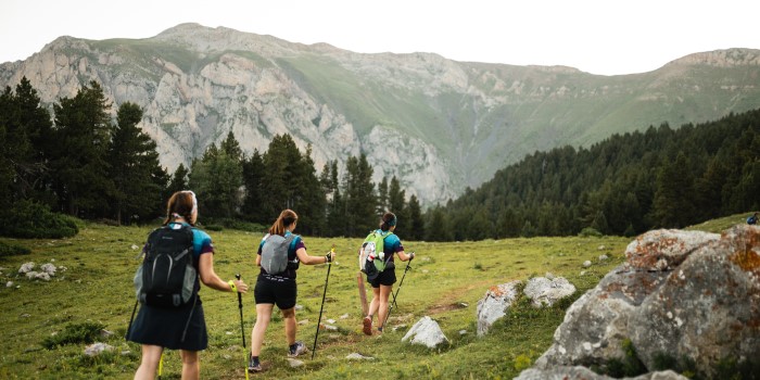
Trail running in the Berguedà region
Via del Nicolau
5 trail running routes in the Berguedà region
Get in shape, while enjoying the freedom of running in nature, whenever and wherever you want, without fees or schedules and without depending on other people. This is trail running, and we have one of the best places in the world to practice it right here: the Berguedà region. It would take you more than a lifetime to complete all the routes the region has to offer, so we have selected 5 of different difficulty levels for you here. Are you in?
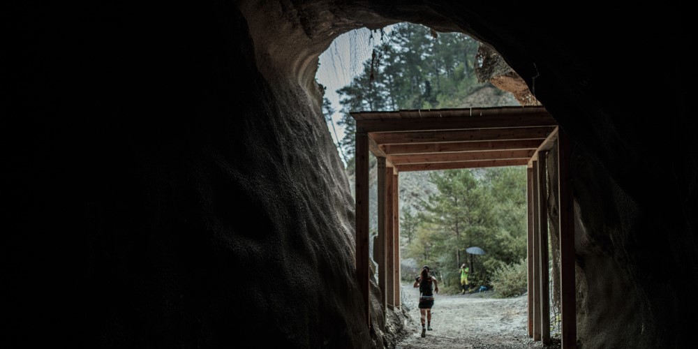
Via del Nicolau
If you are a beginner and want to enjoy trail running while taking a trip back in time, you will love the Via del Nicolau! It is a flat route with little technical difficulty that crosses a forest full of tunnels and walkways, where there used to be an old railway line built in 1914 to transport wood. In 2009, it was restored as a walking trail. If the 14-kilometre route seems too long, you can cut it in half and just do the section between Bagà and Avellanet, returning to Bagà.
Technical details
- Difficulty: Low
- Starting and finishing point: Bagà
- Distance: 14 km
- Elevation gain: 375 m
- Maximum altitude: 943 m
Queralt Sanctuary
This route requires a certain level of fitness, as it includes a significant elevation gain, although it does not exceed 1,200 metres in altitude.
We start in Berga, on Plaça de Sant Francesc, heading towards the Fumanya residential area (km 1), from where we leave the town centre and head towards Queralbs on a climb that will require us to grit our teeth, as we will gain most of the elevation in just 1.5 km. You will probably do it on foot, but do not get discouraged: Very few people can do it running.
In Queralbs, we can stretch our legs a little and start jogging to finish the route, now in a more relaxed manner and enjoying the views, places and chapels it offers.
Technical details
- Difficulty: Low
- Starting and finishing point: Berga
- Distance: 7.5 km
- Elevation gain: 675 m
- Maximum altitude: 1,194 m
Cap de la Gallina Pelada
The route starts and ends at Font Freda de Saldes and runs through the Serra d’Ensija, where you can enjoy breathtaking views of Pedraforca, the Serra del Cadí and Rasos de Peguera that will leave you speechless. Much of the route is above 2,000 metres, so keep this in mind when choosing your equipment.
Technical details
- Difficulty: Medium
- Starting and finishing point: Saldes
- Distance: 10,5 km
- Elevation gain: 875 m
- Maximum altitude: 2.321 m
Cavalls de Vent
Cavalls del Vent is a circular route linking eight shelters in the Cadí-Moixeró Nature Park. Although some runners complete it in 1 or 2 days, most people take between 3 and 5 days, depending on their fitness level, and take the opportunity to enjoy the mountains and nature. We recommend booking accommodation in the shelters where you plan to spend the night.
Technical details
- Difficulty: High (if done in 1-2 days)
- Starting and finishing point: Any shelter along the route
- Distance: 84 km
- Elevation gain: 5.600 m
- Maximum altitude: 2.520 m
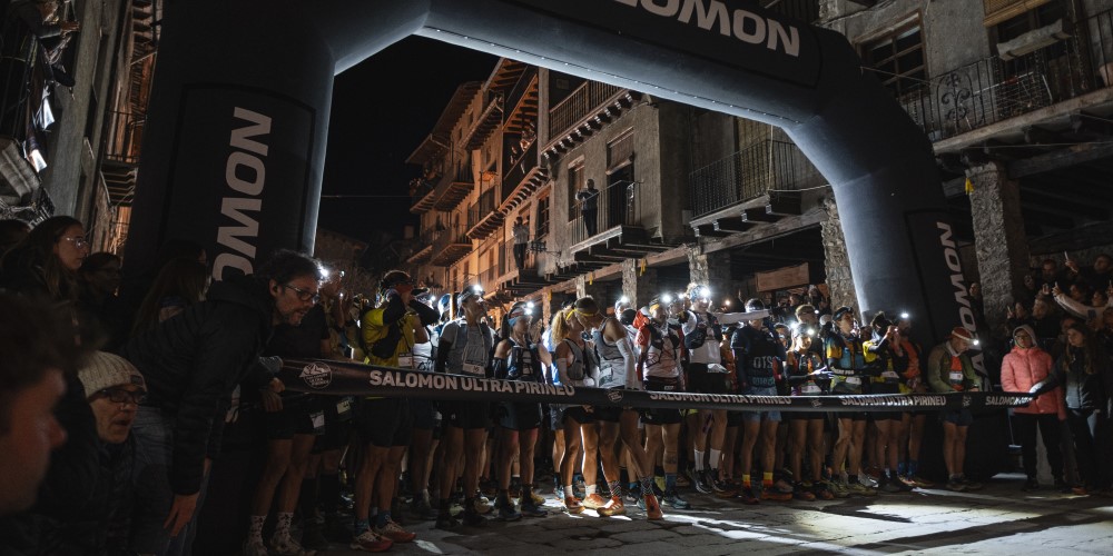
Ultra Pirineu
Signing up for a mountain race is the best way to motivate yourself to train on a regular basis, and we have one of the most important races in the world right here at home, with 4,000 runners from all five continents taking part: the Ultra Pirineu race!
Starting and finishing in Bagà, this race offers four distances for all levels: 100 km, 42 km and 21 km, covering the most iconic spots in the Cadí-Moixeró Nature Park, with sections that run along the Cavalls del Vent trail, the Way of Good Men and the Picasso route.
Best of all, though, is the atmosphere you will find, with crowds cheering you on from every point along the route. If you have children, you can also get them started by signing them up for the XS!
Technical details 100k / 42k / 21k / kv
- Difficulty: Very high / High / Medium / Low
- Starting and finishing point: Bagà / Bagà / Bagà / La Molina – Niu de l’Àliga (Bagà)
- Distance: 100 km / 42 km / 21 km / 5 km
- Elevation gain: 6,600 m / 2,700 m / 1,200 m / 860 m
- Maximum altitude: 2,520 m
Tips and best practices
We have the best climate and geography to enjoy trail running like nowhere else, but we must bear in mind, especially at high altitudes, that we may be surprised by the weather, incidents or injuries in places where our mobile phones may fail us, when we need them most, due to lack of coverage or battery power. To ensure peace of mind and safety, we should not rely solely on technology. Follow these tips to enjoy the trip to the fullest:
- Study the route carefully before setting out.
- Inform someone close to you of your itinerary and expected return time.
- Check the weather forecast, always from reliable official sources.
- Bring extra food and water in case the route takes longer than expected.
- Bring a thermal blanket and clothing to protect yourself from the sun or to cope with unexpected weather conditions typical of the area and time of year.
- Carry a small first aid kit to treat minor injuries.
- When in doubt, always turn back. The mountain will always be there to try again.
- Keep your mobile phone charged at all times.
- Carry a GPS or download maps of the area using mobile geolocation apps, such as Google Maps, Wikiloc, etc.
More information:
Cavalls de Vent
Turisme del Berguedà
Turisme Bagà